Iran Silk Road Tours – Ancient Silk Road Travel 2024
Follow Marco Polo’s footprints to enjoy a once-in-a-lifetime journey to the Ancient Silk Road!
The Silk Road is neither an actual road nor a single route. The term instead refers to a network of routes used by traders for more than 1,500 years, from when the Han dynasty of China opened trade in 130 B.C.E. until 1453 C.E., when the Ottoman Empire closed off trade with the West. German geographer and traveler Ferdinand von Richthofen first used the term “silk road” in 1877 C.E. to describe the well-traveled pathway of goods between Europe and East Asia. The term also serves as a metaphor for the exchange of goods and ideas between diverse cultures. Although the trade network is commonly referred to as the Silk Road, some historians favor the term Silk Routes because it better reflects the many paths taken by traders.
The Silk Road extended approximately 6,437 kilometers (4,000 miles) across some of the world’s most formidable landscapes, including the Gobi Desert and the Pamir Mountains. With no one government to provide upkeep, the roads were typically in poor condition. Robbers were common. To protect themselves, traders joined together in caravans with camels or other pack animals. Over time, large inns called caravanserais cropped up to house travelling merchants. Few people traveled the entire route, giving rise to a host of middlemen and trading posts along the way.
An abundance of goods traveled along the Silk Road. Merchants carried silk from China to Europe, where it dressed royalty and wealthy patrons. Other favorite commodities from Asia included jade and other precious stones, porcelain, tea, and spices. In exchange, horses, glassware, textiles, and manufactured goods traveled eastward.
One of the most famous travelers of the Silk Road was Marco Polo (1254 C.E. –1324 C.E.). Born into a family of wealthy merchants in Venice, Italy, Marco traveled with his father to China (then Cathay) when he was just 17 years of age. They traveled for over three years before arriving at Kublai Khan’s palace at Xanadu in 1275 C.E. Marco stayed on at Khan’s court and was sent on missions to parts of Asia never before visited by Europeans. Upon his return, Marco Polo wrote about his adventures, making him—and the routes he traveled—famous.
It is hard to overstate the importance of the Silk Road on history. Religion and ideas spread along the Silk Road just as fluidly as goods. Towns along the route grew into multicultural cities. The exchange of information gave rise to new technologies and innovations that would change the world. The horses introduced to China contributed to the might of the Mongol Empire, while gunpowder from China changed the very nature of war in Europe and beyond. Diseases also traveled along the Silk Road. Some research suggests that the Black Death, which devastated Europe in the late 1340s C.E., likely spread from Asia along the Silk Road. The Age of Exploration gave rise to faster routes between the East and West, but parts of the Silk Road continued to be critical pathways among varied cultures. Today, parts of the Silk Road are listed on UNESCO’s World Heritage List.
The Silk Route also helped missions by Buddhist and European monks and was instrumental in spreading Buddhism, Christianity, Islam, Hinduism, and other religions throughout the regions served by the routes.
In order to help you better explore the cultural and natural splendor of the Iran Silk Road, you can customize a Silk Road tour according to your own interest, travel length or budget. Besides, we offer the most-updated travel information and travel guide about Silk Road which assist you with a full preparation for your coming Silk Road holiday in advance.
14 Best IRAN Silk Road Destinations with Top Things to Do
according to the ancient maps, the Silk Road Started from the coastal cities of East China and to prevent crossing the central deserts of China, the great Silk Road was divided into northern and southern roads. This road started from the Jade Gate and reached Kashgar, through Turfan (North Road) and Khotan (South Road), then to Samarkand, Samarkand to Merv and Balkh. We can say that the peak of trading relations between North Iran and China was under Iranian Sassanian Empire. Although during this period, in addition to producing several types of paper in Iran, we also imported paper and silk from China. Silk Road in Iran on the east-west axis, entered present Khorasan and reaches ancient city of Rey via the towns of Toos, Neyshabur, Sabzevar, Shahroud, Damghan, Semnan and gets divided into two branches from Rey or Qazvin– The most important spots. From Qazvin one way northwest to Sarab, Tabriz, Marand and then Khoy and out of the country and the other way west to Ekbatana (today Hamadan) and then Kermanshah and out of the country.
This is the main path that has been confirmed by important historical sources and world references such as UNESCO.
Today, the restoration and revitalization of the Silk Road and remains of ancient monuments around it, can be of great interest to visitors. Another important point to know is that Iran is the only country where the Road and the sea have collided across the Persian Gulf .
The 14 Silk Road destinations and what to do in each place are covered below in order of recommendation.
Toos or Tus
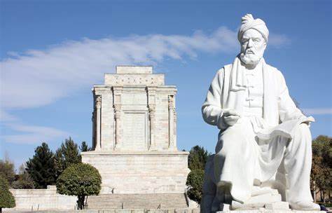
Tus, also spelled as Toos, is an ancient city in Razavi Khorasan Province in Iran near Mashhad. To the ancient Greeks, it was known as Susia. It was also known as Tusa. Tus was divided into four cities, Tabran, Radakan, Noan and Teroid. The whole area which today is only called Tus was the largest city in the whole area in the fifth century. In Sassanian Dynasty, Toos was one of the cities in the route of Gorgan and Nayshabur to Marv, Nessa and finally towards west. After the Nahavand war, a way was paved for passage of Arab soldiers to the east. In the year 29 – 30 AH, Khorassan was conquered by Abdollah bin Aamer and thus the area of Toos came under the jurisdiction of the western Islamic territories. The tower and ramparts (walls) around the city made of brick along with a dome standing 25 m. in height which is called ‘Gonbad-e-Harooniyeh’ or the Dome of Harooniyeh, these are counted as the monuments of the ancient city of Toos. In this city several pieces of earthenware, glass, brick and even metal have been discovered, and the evidence of these relate to the Sassanian, Saljuqian, Teimoori and the Qajar periods.
Recommended Tours
Visiting Tomb of Ferdowsi ( Iranian famous poet ) in Toos and the Dome of Harroniyeh
Excursion to mashad to visit holy shrine of 8th imam of shia ( Reza )
Excursion to Neishabur city
Shandiz
Torghabe
Nader Shah Park & Mausoleum
Saffron tour
Related Posts:
Nishapur
Nishapur officially romanized as Neyshabur is one of the oldest cities of iran which was located on the Silk Road in the past , it was found by Shapur I (241-272) or Shapur II (309-79) in the Sassanian period. The town is named after them. In the Sassanian and early Islamic period, the city was also named as Abarshahr. The archeological excavations have not yielded sufficient traces of its Sassanian origin. As is the case with many ancient and medieval cities, it is possible that the actual location of the older cities might be several kilometres away from today’s Nishapur.
According to Arab historians Tabari and Baladhuri, the Sassanian city fell to the Third Caliph Othman (644-56). In fact, the uprising against the Umayyad Caliphate started in Khurasan by a Persian named Abu Muslim, who entered Nishapur as a conqueror in 748. By 750, the Umayyad Caliphate ended and the era of Abassid Caliphate started. The seat of power shifted from Syria to Iraq. This is one of the most prominent events of the history of Arabs.
In the 9th Century, Khurasan became an autonomous region under Tahir ibn al-Husain, with the capital city as Merv. This dynasty was known as the Tahirids. The second in line, Abdallah chose Nishapur as its capital stating that the weather and people were more agreeable. Approximately 5 kilometres from the city of Nishapur, Abdallah established his Palace and quarters names Shadyakh. Under the Tahirids, the later Safarids and Samanids, Nishapur entered a Golden era of prosperity. Although the Samanids had their capital at Bukhara, Nishapur was an important city. Under the Samanids, Nishapur became an international trading centre. From Ghaznavids, the power passed to Seljuqs under whom Nishapur became part of a large empire.
Nishapur was possibly located in a high seismic zone as its history is full of reference to earthquakes and in one account, it is said that the city was destroyed and re-built eighteen times. Despite all this, there was a time when Nishapur rivalled Baghdad and Cairo as a cultural, intellectual and trading centre.
In 1221, the army of Genghis Khan destroyed the city and killed all its inhabitants. His favourite son in law was killed in Nishapur and to avenge his death, Genghis’s son Tolui destroyed the city. After this event, the city could never recover its past glory. It is said that the famous poet Farid-ud-din Attar perished in this mayhem.Neyshabur was a source of turquoise and a center for growing cotton, producing cotton textiles as well as several types of fabric incorporating silk.
Recommended Tours
- Visiting mausoleum of omar khayyam
- Visiting turquoise shops
- Visiting tomb of Attar Neishaburi
- Visiting Neyshabur museum
- Excursion to mashad to visit holy shrine of 8th imam of shia ( Reza )
Related Posts:
Sabzevar
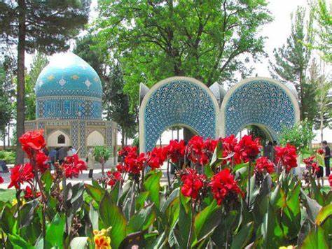
Sabzevar is a city in Razavi Khorasan Province in northeastern Iran . Sabzevar history dates back to 1st millennium BC. It is believed that, more than 90,000 people were killed by Timur during 14th century. The ruins of ‘Azarbarzin’ fire-temple are found in Sabzevar. Sabzevar is situated about 220 kms west of provincial capital Mashhad .
Sabzevar is home to many food processing, cooper ware and electric motors industries. The old bazaar of Sabzevar offers buyers with fresh, dried, and preserved fruits and vegetables. January and February are the ideal months to visit Sabzevar when the weather remains invariable and several cultural events are organized in Sabzevar during these months.
Recommended Tours
- Visiting Yahya Monument & Mil-e Khosrow Gerd which is an ancient building which is ‘the brick tower of king Khosrau’. It is the highest brick tower in Sabzevar.
- Visiting Masjed Jameh
- Excursion to cities around sabzevar like neishabur and mashad
Related Posts:
Shahroud
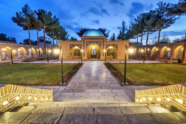
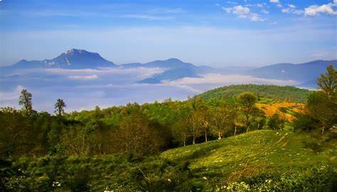
Shahroud is located in the north of Kavir desert and in the south foothills of the Alborz mountain range with the height of 1380 meters above the sea level.The climatic conditions in the south of Shahroud are arid and warm due to its vicinity to desert and the weather in central and eastern parts is moderate and the north part is mountainous with cold and arid climate.
Shahroud county consists 6 cities as “Shahroud”, ”Bastam”, ”Mojen“, ”Kalate Khij”, ”Beyarjomand“ and “Meyami”, and 7 rural districts.
Available water resources, beautiful nature, fertile lands, the biggest wildlife havens and protected zones, mineral resources, climate variability, mountains and highlands, historical and religious monuments and variety of handicrafts have increased the importance of city. Shahroud is known as one of the ecotourism centers of Iran due to having the appropriate connections: being located on the way of Tehran-Mashhad road and also on the way of the important and historical Silk Road and vicinity to the central and the northern provinces of the county.
Shahroud tourist attractions
Clouds Forest
Bayazid bastami tomb
Kharaqani tomb
Khar Turan National Park
The House of Yaqmai’ha
Shahroud Museum
Aqa Mosque of Shahroud
Water Museum of Shahroud
Sarcheshmeh Bridge
Friday Mosque of Shahroud
Historical Bazaar of Shahroud
Shah Abbasi Caravansary Complex of Miandasht
Reza Abad-e Kharturan
Qaleh-ye Bala Village
Mojen Village
Reza Abad Desert
Damghan (Hecatompylos)
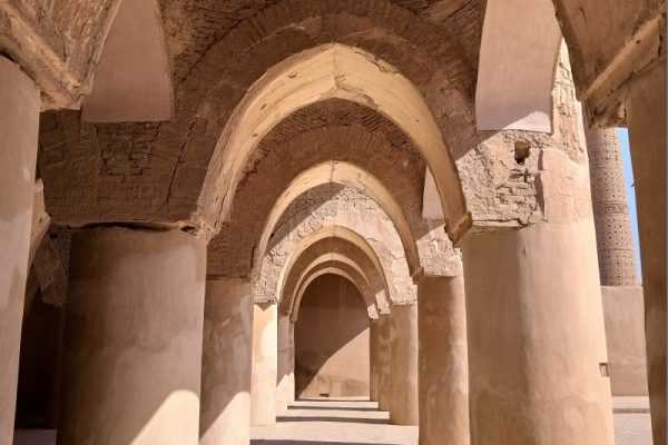
Known as the city of a hundred gates, Damghan was a safe capital for the Parthian Dynasty (247 BCE – 224 CE). Part of the ancient city walls that used to protect the city and its monuments are still standing there.Merchants and businessmen have visited this city because it is located on the Silk Road. This is the reason why there are remnants of several caravansaries, castles, and towers in the historical quarter of Damghan . Damghan is the second-largest city for the pistachio production in Iran. A part of the economy of the city depends on pistachio and agricultural gardens.
Damghan tourist attractions
Tarikhaneh Mosque (former fire temple)
Tappeh Hesar
Tughrul Tower of Damghan
Friday Mosque of Damghan
Lotfi House
Tomb of Pir-e Alamdar
Chehel Dokhtar Tower
Imamzadeh Jafar
Imamzadeh Mohammad
Tomb of Shahrokh, the Timurid
Zangooleh
Baru Wall
Fathali Shahi Building
Bazaar of Damghan
GerdKuh Castle
Shirband cave
Siah Khani Forest
Jahan Nama Protected Area
Cheshmeh Ali
Ramly Desert
Semnan
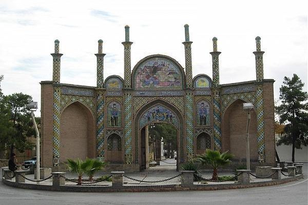
The history of Semnan dates back to ancient Iran when the city was part of the Median (678 -549 BC) empire. In the Parthian era (247 BC–224 CE) Semnan became part of Qumis Province (modern day Semnan Province). In Sassanid (226-651 CE) Iran, Semnan was the province that separated Arsacia (modern day Tehran Province) and Hyrcania (modern day Gilan, Mazandaran and Golestan Provinces). the city of Semnan is located south of the Alborz Mountain Range and north of the Great Salt Desert or Dasht-e Kavir. Semnan neighbors the city of Mahdishahr in the north, the city of Damghan in the east, the city of Sorkheh in the west and Dasht-e Kavir and Isfahan Province in the south. This city has dry weather but experiences all four seasons . Having over 600 kilometers of common Silk Road routes is also one of the major criteria of Semnan . The ancient Silk Road has existed for thousands of years, passing through empires, kingdoms, reigns, and societies throughout history. At certain times in its long history, traders could travel freely along these routes, whereas at others, travel was difficult or dangerous.
Semann tourist attractions
Chehel Dokhtar Tower
Jame Mosque
Pahneh Bathhouse
Archeology and Anthropology Museum
Soltani Mosque
Parvar Protected Area
Arvaneh Caves
Semnan Thermal Spring
Rey
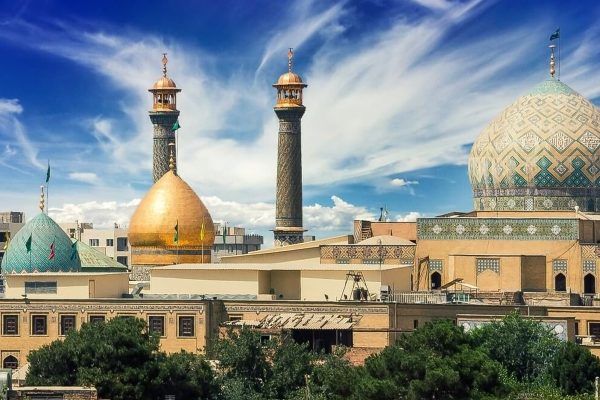
Rayy or Rey was one of the great cities of Iran. The remains of the ancient city lie on the eastern outskirts of the modern city of Shahr-e Rey, which itself is located just a few miles southeast of Tehrān.
A settlement at the site dates from the 3rd millennium BC. Rey is featured in the Avesta (the original document of Zoroastrianism, an Iranian religion) as a sacred place, and it is also mentioned in the book of Tobit, of the biblical Apocrypha, and by classical authors. Rey was one of the capital cities of the Parthian empire (3rd century bce–3rd century ce). It was captured by the Muslim Arabs in 641 ce. During the reign of the Muslim caliph al-Mahdī in the 8th century, the city grew in importance until it was rivaled in western Asia only by Damascus and Baghdad. Islamic writers described it as a city of extraordinary beauty, built largely of fired brick and brilliantly ornamented with blue faience (glazed earthenware). It continued to be an important city and was briefly a capital under the rule of the Seljuqs, but in the 12th century it was weakened by the fierce quarrels of rival religious sects. In 1220 the city was almost entirely destroyed by the Mongols, and its inhabitants were massacred.
after the Mongol conquest the town was severely damaged and it gradually lost its importance in the presence of nearby Tehran. There is also a shrine there, dedicated to commemorate Princess Shahr Banu, eldest daughter of the last ruler of the Sassanid Empire. She gave birth to Ali ibn Husayn Zayn al-Abidin, the fourth holy Imam of the Shia faith. undefined This was through her marriage to Husayn ibn Ali, the grandson of Muhammad, the prophet of Islam. A nearby mountain is also named after her. However, some sources attribute the shrine to the goddess of water and fertility, Anahita, claiming it was renamed in Islamic times to protect it from any possible harm after the conversion of Iranians to Islam. In the middle of the 19th century, Ray was described as a place of ruins, the only settlement being around the shrine of Abdol Azim. Being the only important pilgrimage site in vicinity to the royal court in the new capital Tehran brought more people to visit the shrine and a major restoration was sponsored by the court. Ray was the first place in Iran to be connected to the capital by a railroad in 1888.
There are lots of ancient places to visit in Rey city, such as Toghrol Tower, Cheshmeh Ali and Rey Castle, Hazrat Abdol Azim Hassani Holy Shrine, Naqareh Khaneh Tower, Iraj Castle (Gebri Castle), Rey bazaar and Rey Fire Temple (Bahram Fire Temple).
Related Posts:
Sarab
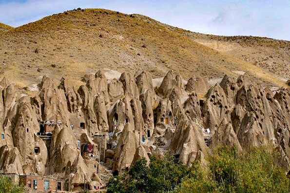
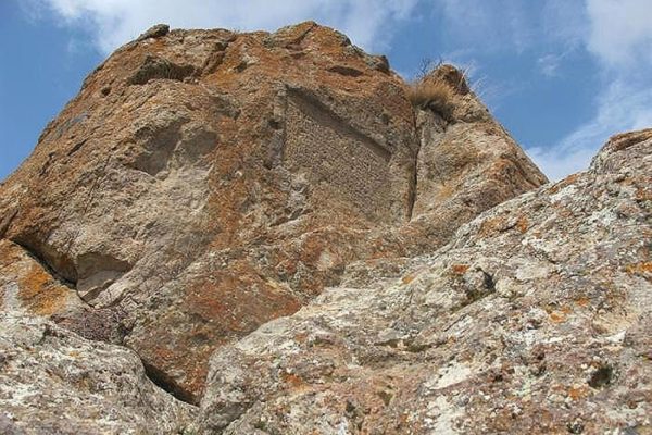
Sarab is located east of the province of East Azarbayjan province of IRAN . Sarab resting amongst the high mountains of Bozqoosh and Sahand. It has a mountainous and moderate climate, with extremely cold winters and pleasant summers. Sarab being one of the oldest towns of this province bears ancient monuments. Due to the surrounding volcanoes, mineral water is in abundance. The volcanic mountains situated around the city contain a large number of spa waters, and streams. Some of the interesting places in Sarab are the stony Epigraph Orratoey Qirax Qizlar, the stony Epigraph of Razliq which is located 12 km north to the town of Sarab, fireplace (Chahar Taqi) Agmiyan which is located north-east to the city of Sarab and belongs to the Sassanid period, the stony caravan Sara Saein which belongs to the Safavid period, the old and stony mosque Jamalabad and Asneq which are located in Alan Baraghoush, and belongs to the early Islamic period, the Jami mosque of Sarab which belongs to the 9th century AH and the spa waters such as Allah Hag, Abres and Sarab. Sarab is famous for its rugs. The rugs of Sarab, which are also classified among those known as Heriz, have light, rather bright colour schemes. The usual adjective for “of Sarab” would be “Sarab-i”, this changed to “Serapi”. In 1876, about the time that Sarabi rugs were coming on the market in England, the Prince of Wales made a trip to India on H. M. S. Serapis. The similarity of the names led to the form “Serapi” for the rugs.
Marand
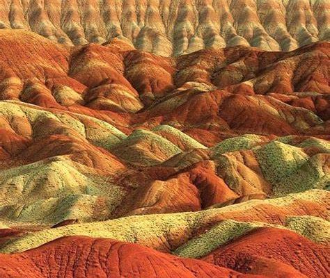
Marand lies northwest of the province and is semi mountainous. The historical city of Marand is 71 km Tabriz, having cold winters and moderate summers. Marand has been famous from long past such as the Assyrian and Kaldeh when it was a center of importance. It is narrated as being a place of burial of the prophet Noah. Its name being derived from the Pahlavi word Madvand meaning the ‘living place’ of the Medes. This area has also been subject to upheavals in the past. The history of the town goes back to the pre-Islamic era. Between 815 till 850, Marand was primarily controlled by Mohammad ibn Ba’ith who was Iranicized to a considerable extent. The elders of Maragha who quoted his Persian poetry also praised his bravery and his literatry ability. He was Iranicized to considerable extent and the statement of Tabari on him is evidence of the existence of the cultivation of poetry in Persian in northwest Persia at the beginning of the 9th century.
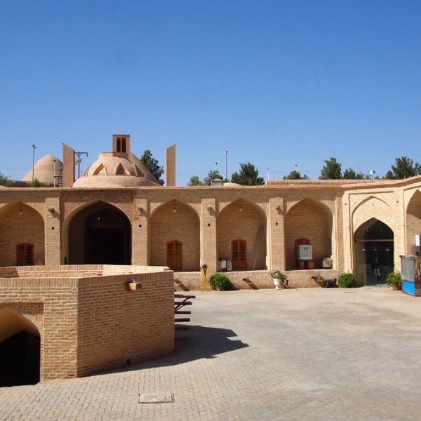
The Yam caravanserai is located at the slopes of the Mishu mountains, in the city of Marand (eastern Azerbaijan region). It dates back to the Mongol and Safavid period, being on the transit route between Iran and Europe, and on the Silk Road, it has always aroused interest and is considered one of the most important transit structures in different historical periods. Aladaglar mountains on the way from Tabriz to Yam caravansary can visit.
Marand tourist attractions
Sassanid Fire Temple
Marand Jame’ Mosque
San Sarood Castle
Kiyamaky Protected Zone
Payam Ski Resort (Yam)
Mishoo Mountains
khoy
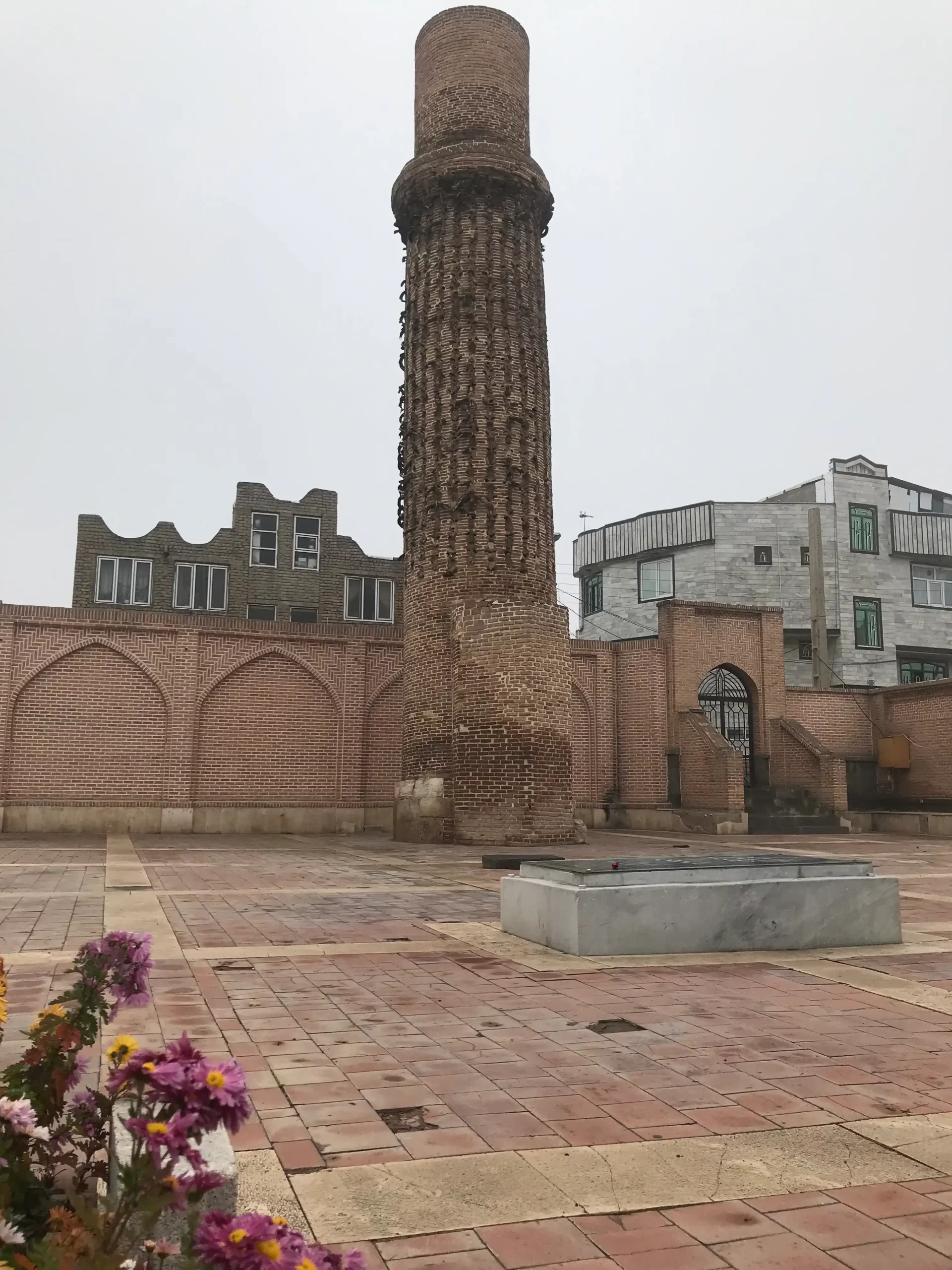
Khoy is a city in West Azerbaijan Province, Iran.The region’s economy is based on agriculture, particularly the production of fruit, grain, sunflower and timber.
Khoy was named in ancient times for the salt mines that made it an important spur of the Silk Route. 3000 years ago, a city had existed on the area where Khoy is located nowadays, but its name became Khoy only from 14th centuries ago. In 714 BC, Sargon II passed the region of which Khoy is part of in a campaign against Urartu.
Khoy is located in the mountains, so the weather is very cold in winter and cool in summer. Spring weather in this city is very pleasant. The city is located in the vicinity of mountains such as Chelekhaneh Mount and Avrin Mount (The highest mountain of West Azarbaijan Province).
Khoy Tourist attractions
Tomb of Shams Tabrizi, Shams Tabrizi Tower
St. Sourp Serkis Church
Bastam and Bolourabad Castles
Khatoon Bridge
Old Stone Gate
Old Bazaar
Motallebkhan Mosque
Mount Avrin
Ghotour Iron Bridge
Pourya-ye Vali tomb
Hamadan Related Posts:
