Tabas travel information
Tabas is located in central Iran, in South Khorasan Province, and it is situated 950 kilometers southeast of Tehran, with the altitude of 667 meters (2,188 feet) above sea level. It used to be part of the Great Khorasan province .The city is located at the heart of the desert amazingly with beautiful date and citrus gardens.
The history of Tabas dates back to pre-Islamic times, in which the city was an important outpost of the Sassanid Empire. During the Arab invasion it was considered the gateway to Khorasan, and later it was spared when the Mongols attacked the country.
The 1978 Tabas earthquake with 7.4 on the moment magnitude scale affected the city with a maximum Mercalli intensity of IX (Violent), and unfortunately, at least 15,000 people were killed. Since then, the city has been rebuilt with many new streets, parks and public buildings.There are many cultural-historical and ecotourism attractions in Tabas Geopark, along with its considerable geotourism potential, the ancient citadel of Tabas, the ancient Korit Dam (the oldest, tallest, and thinnest arched dam in the world), Shah Abbasi Arch, as a masterpiece of engineering and architecture of our predecessors, caravanserais, schools, mosques, and water reservoirs are part of the most prominent cultural-historical buildings of this geopark.
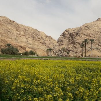
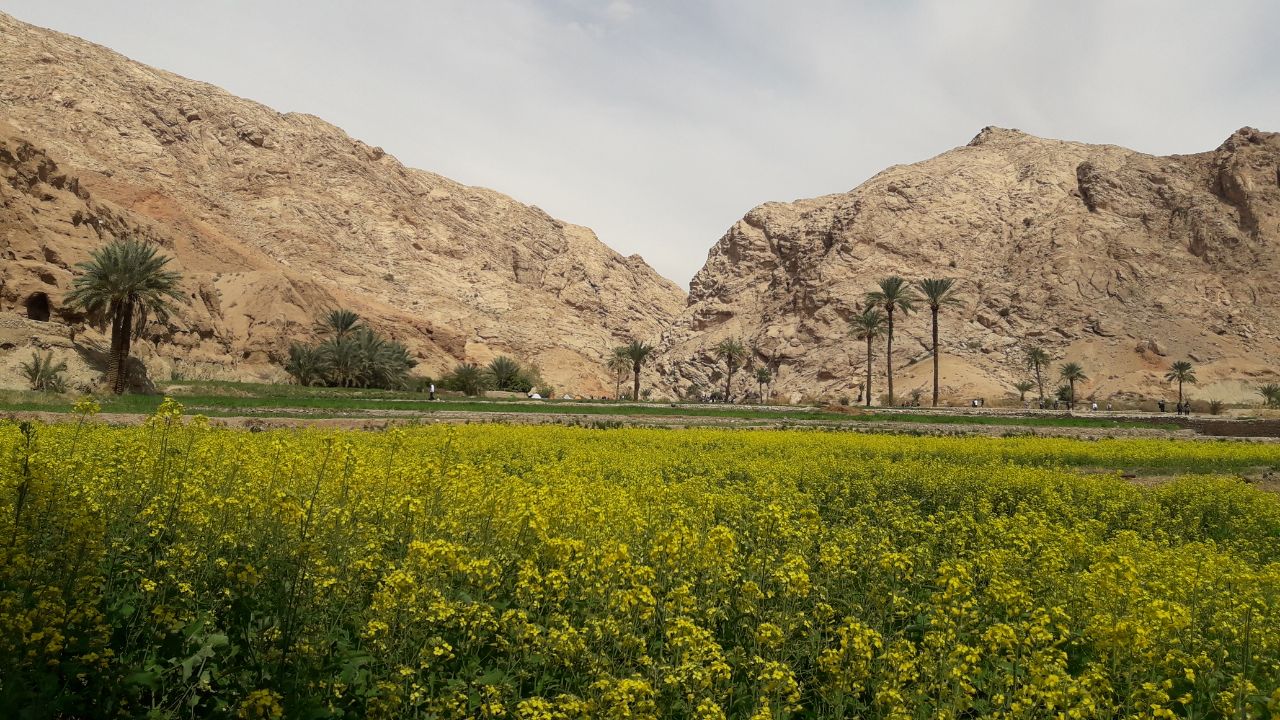
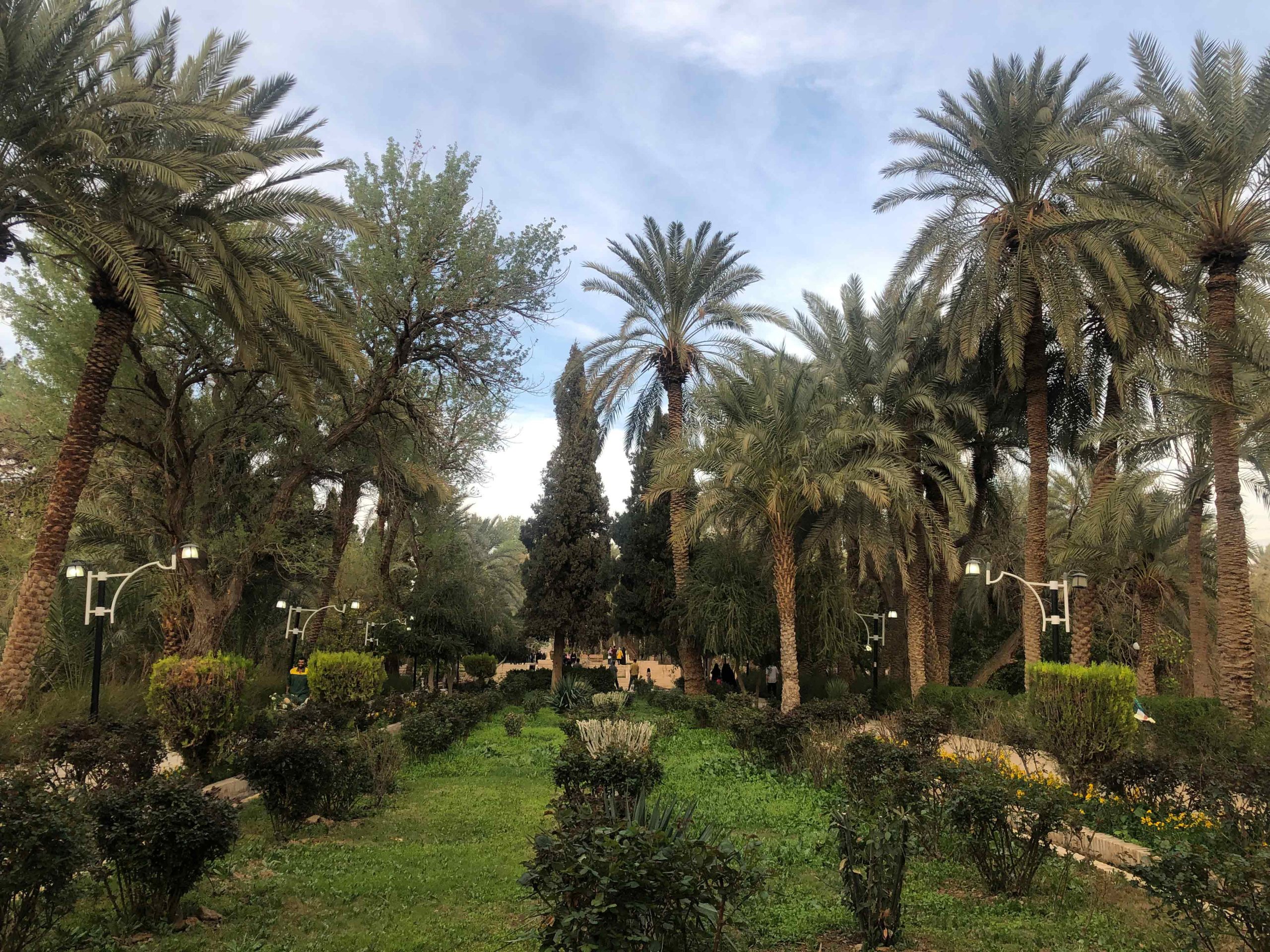
There are a number of date and citrus gardens in the city where you can spend a few hours relaxing and enjoy the peace and silence, especially during the spring when you can smell the fragrance of citrus blossom. In addition, Morteza Ali Canyon, Golshan Garden, Nay Band Village, and Kal-e Jeni are the most visited places in the area. In the following, we are going to introduce these places briefly.
Tabas UNESCO Global Geopark
Tabas UNESCO Global Geopark with an area of 22771 km2, is located in the northwest of South Khorasan province, acting as a transportation highway from south and west to east and northeast of Iran in a desert area with a hot and dry climate. This geopark includes three districts of Central, Dastgerdan, and Deyhuk. Many geologists have called Tabas the geological paradise of Iran due to its high geological richness and diversity in terms of unique geological phenomena. This geopark reflects the evolution of the planet from Precambrian (540 million years ago) to Early Cretaceous (around 100 million years ago) without the slightest interruption, while its Paleozoic successions from the first geological period (Paleozoic, 250 to 540 million years ago) are unique in Iran and west Asia. the Paleozoic Rock Outcrops found in Tabas UNESCO Global Geopark are the most comprehensive series from this geological period.
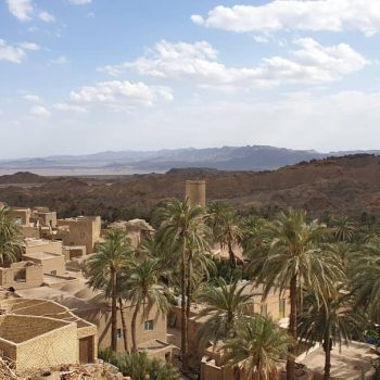
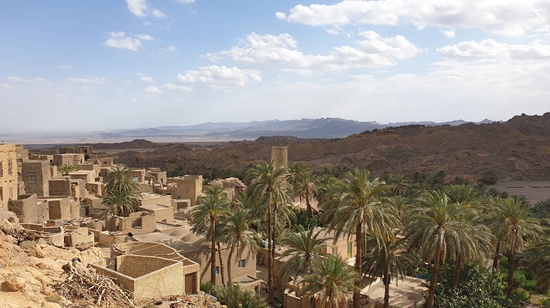
Esfahak Village
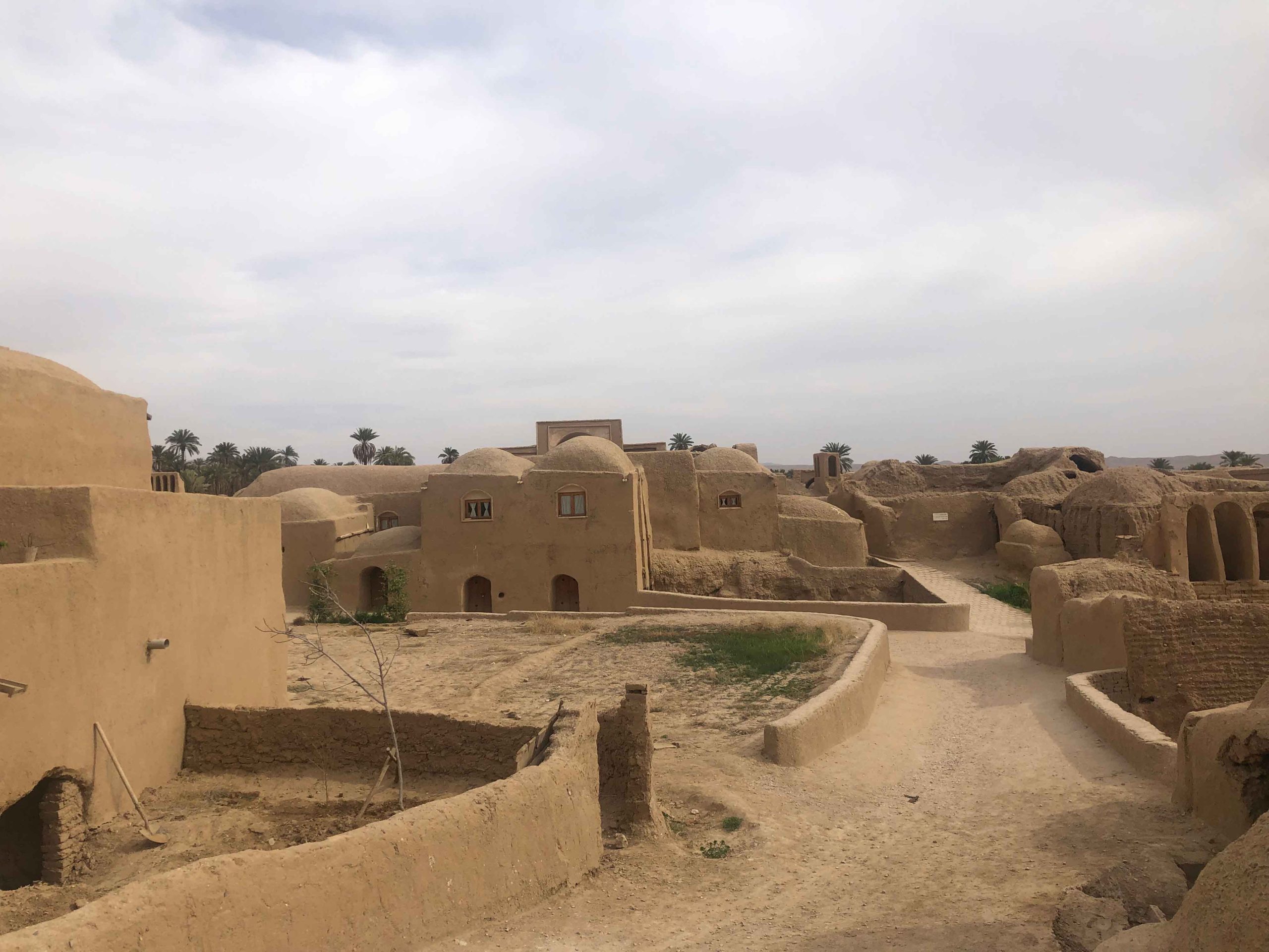
The Esfahak Village is a 400-year-old village located in the heart of the desert in iran and palm tree gardens with a special climate, because of the mountains around this village, and also the water wells and fresh water Qanats that have been dug by residents for 400 years ago. A big part of Esfahak Village was destroyed by the harsh earthquake of Tabas in September of 1978, and the surviving locals and residents abandoned their village and migrated to neighboring cities. But in recent years, children of locals of Esfahak Village, who are now grownups, decided to revive their village and little by little changed it into a touristic village.Arched doorways, domed roofs with skylights, and small windows are among the features of the old houses in Esfahak. There is also a historical bathhouse in the village which has been restored. Date and saffron are the main products in Esfahak.
Ezmiqan village
One of the sites of Tabas is Ezmeyghan Village which is located 40 km of tabas , a unique place where rice lands and lands of date trees meet. In fact, people of Ezmeyghan plant all kinds of fruits and vegetables in their village. But it is the cultivation of both rice and date in one place that makes Ezmeyghan interesting. This is a feature that can be seen in no other place. There is a permanent river that runs through the village and has contributed to the better growth of the products.
The texture of the village is similar to those of other desert villages. Most of the houses are made of clay, raw cob bricks, soil, and pieces of wood.
Tomb of Seyed Muhammad ibn Ja’far Tayar is located in Ezmeyghan Village and is one of its many attractions. This religious building is positioned on the top of a mountain. It has a great view of the village. The tomb has been damaged and then repaired many times in history. It was after the damage from the heavy earthquake of 1357 SH that it was repaired for the last time. However, the history of the tomb traces back to the early years of Islam. According to the historical documents, the Muslims killed Muhammad Jafer Tayar when they conquered Khorasan. This means that the tomb was built in 29 or 30 AH.
Takhte Arous is another tourist site of Ezmeyghan. Its name literally means the bridal seat, and the reason for this is that it is a huge white rock located at the bottom of a valley, where a river also runs.
There are two Arabic-like scripts in Ezmeyghan. Some believe that they belong to Muhammad Ja’far ibn Tayar
Ezmeyghan is beautiful in all the seasons of the year. In spring, the natural environment of the village becomes very eye-pleasing. During summer, the rice fields become mesmerizing. And in autumn and winter, you can enjoy fair and moderate weather.
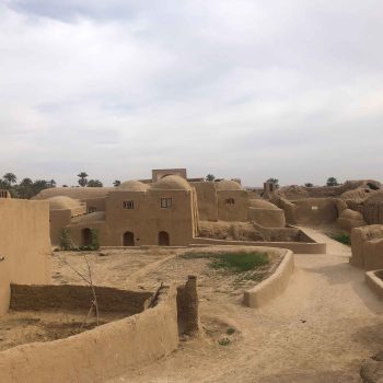
Korit village
Korit is one of the oldest villages in Tabas, dating back to more than a thousand years ago. This historical attraction of Iran had valuable historical monuments before the devastating earthquake that hit the region in 1978.
Magnitude 7.4 earthquake occurred on September 16 destroying the old and historic village of Korit which was a very beautiful and lovely place. The damage of the earthquake can be clearly seen all across the village.
The village was moved to a new place next to the old one after the earthquake; while its remnants were abandoned in a semi-ruined state. This place is considered by many as a tourist destination and historical attraction, especially for its water reservoirs that belong to Afsharid dynasty.
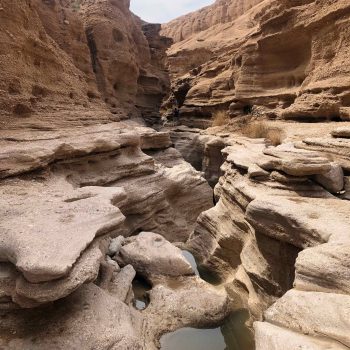
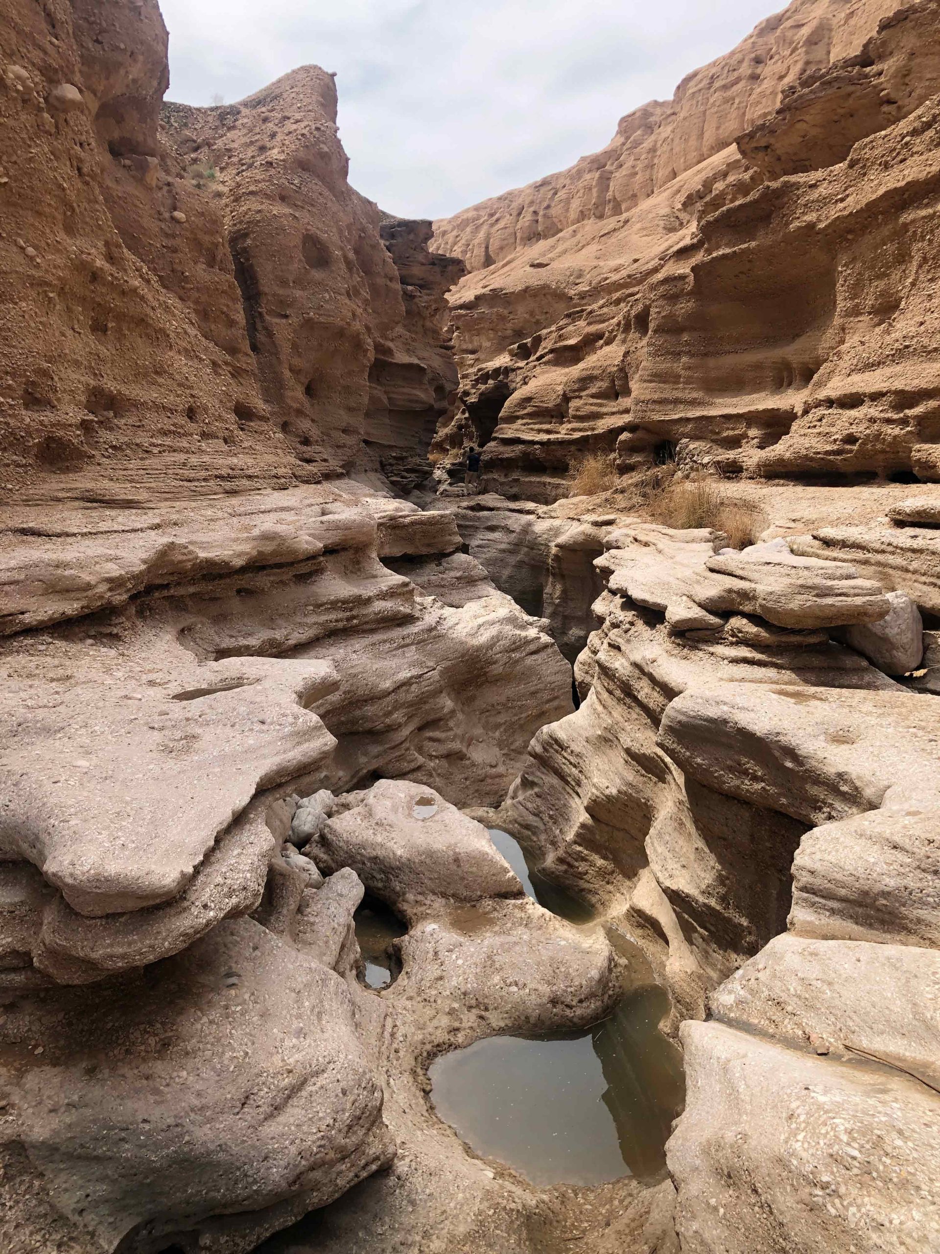
Morteza Ali Canyon
At Kale’ Sar Dar valley, around Kharv village, there are a number of small and big springs with some cavities and channels, which is believed that dates back to Sassanid Dynasty (early 3rd century AD until 651).
Walking along the stream of water for about one hour brings you to the biggest one which is flowing from a cavity, names called Morteza-Ali Canyon. If you continue walking through the spring, you will notice that the valley is getting narrow and the small springs flow into the valley. The interesting point about this canyon is the structural difference with the running water at the riverbed lead to a flow of about 300 meters of the riverbed, while they are not completely mixed together, hot water flows to the river from the right side, and cold water of the river flows to the river from the left side.
Continuing the way we encounter Shah-Abbasi Dam (Tagh-e-Shah-Abbasi) with 60 meters height which is known as the highest historical buildings in Iran!
Hosein Ibn Mosa Alkazem Holy Shrine
Hosein Ibn Mosa Alkazem Holy Shrine is located in Tabas, Southern Khorasan Province. Hosein Ibn Mosa Alkazem is Imam Reza’s brother. It is one of the religious attractions of this city that many pilgrims are eager to visit. According to some documents, the first grave of this Imamzadeh was built on the fifth century AH. The space of this Imamzadeh is beautifully decorated with palm trees, pools and fountains which have created a very good-looking atmosphere. The tomb dome is also very beautiful and adorned with mosaic tiles. Four small minarets, each with a height of six meters in four corners of the shrine’s roof, have given a special beauty to the shrine complex. This Imamzadeh has facilities including several suites and pavilions, a public kitchen, a Saqa Khaneh, a telecommunication office and 36,000 square meters of green space, a water fountain, a convenient bathroom, a playground and a car stop.
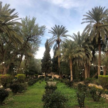
Golshan Garden
It is believed that the garden goes back to the Zand and Qajar dynasties about 300 hundred years ago, and was constructed by order of Mirza Hassan Khan who was the third appointed governor of Tabas by Nader Shah Afshar at Afshariyeh era.
The garden covers an area of 8 hectares, and currently used as a public park. The garden has been constructed and developed in compliance with Iranian garden architecture, with two crossed water streams. At the center point of this garden, there is a pond where habitat of a number of birds, including two beautiful pelicans. In addition, there is also an eight-acre monument with different fruit trees in each.
Nay Band Village
Nay Band Village has a unique architecture, and all houses are constructed in a vertical line where the roofs of lower houses are used as the yard of the upper houses. In addition, roofs of the houses in Nay Band are made of wood and a special type of soil; consequently, in summer people feel cool in the houses. Also, if an earthquake happens, less destruction would take place.
People of Nay Band village are engaged in farming and animal husbandry because of the subterranean canals, known as “qanat” in Persian, and sprigs. Although the population of this village has decreased, there are building constructions, showing the expansion of Nay Band village.
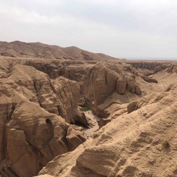
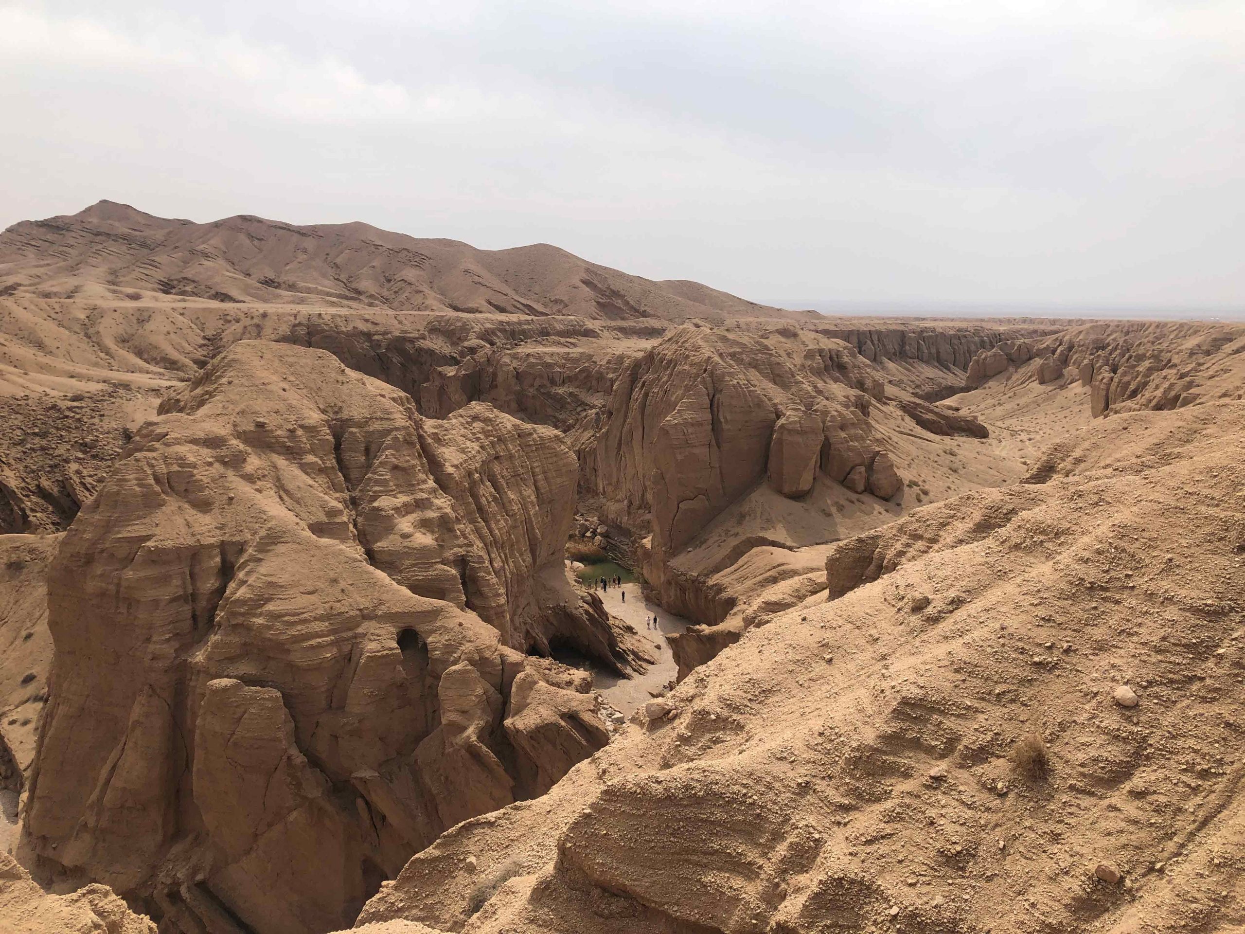
Kal-e Jeni
Kal-e Jeni canyon is shaped by water movement and erosion during centuries. There is a canal to a village called Tashkuni which carries the water of Kal-e Jeni canyon. People believe this is where Cyrus the Great has spent 16 years of his life.
The name means canal of Jinn! Historians believe there are some reasons for this naming. First is the mysterious looking columns, walls, and arcs in this valley. The second reason is locals’ belief, they believe this place was the house of aliens. The other reason is that there are rooms carved into the walls of the valley which their real function is not found yet. However, the historians believed that the followers of Mithraism used these rooms to hold their Cheleh (the ceremony in which they isolate themselves for forty nights in one place) in them.
As locals think this is a cryptic place, Kale Jenni canyon has not been visited by many tourists during the past decades. But now people have understood that it is one of the astonishing places offered by Mother Nature. So many visitors decide to visit here each year.